
To reach the landing site take Route 1A (map) North from Boston, toward
Newbury, about 30 miles, and cross the Parker River.

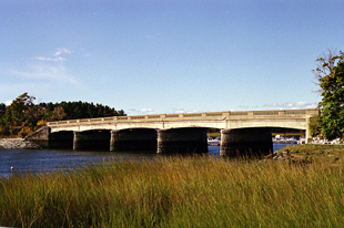
This first photograph shows the bridge over the Parker River on Route 1A,
just as you enter
present-day Newbury. The
Atlantic Ocean is to the left. The salt marsh hay, shown in the foreground, was
mixed with mud to create thatch, a building material for the first homes.

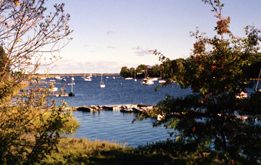
The photograph to the right shows the view, from the Parker River bridge, toward the Atlantic Ocean, in October, 2001. The landing site is on the left bank, where the river makes a turn toward the right.
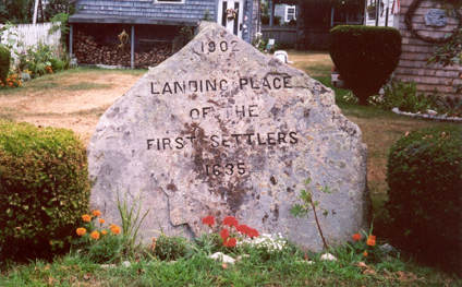
To reach their landing site: Immediately after you cross the Parker River, on your left will be the Lower Green. At the end of the Lower Green turn right on Cottage Road toward the Atlantic. Follow it to the end, where you will find a stone marker at the beginning of the parking area and current boat landing.

The official Web site of Newbury gives the following account of this early history, provided by the Massachusetts Historical Society:
"The Plantation of Newbury is located in the northeastern portion of Essex County. Pawtucket Indians hunted, fished and captured seasonal runs of smelt, alewives, shad, salmon and sea-run trout before settlers appeared. The shellfish were especially plentiful on Plum Island and were appreciated by the 100 people from the Wiltshire and Hampshire sections of England who established the first Colonial settlements. The settlers were younger and more socially prominent than settlers of other towns in the area, and were forced out of England by declining economic opportunities. In 1635, Reverend Thomas Parker from Wiltshire applied to the General Court for the liberty to settle and begin a plantation on land that is now Newbury. The proprietors made the land grants in such a way that 60% of the land was controlled by 10% of the population.
As the community grew, fishing became an important industry, as did small scale shipbuilding, weaving, tanning and shoemaking. Farmers dealt in cattle and sheep and by 1791 there were 3,000 head of cattle grazing on town lands. About the same time, the town set a pattern of diversified industry, producing woolen goods made by the first American-made wool carding machines as well as snuff, chaises and slate. Competition from England's woolen mills decreased the emphasis on woolens and led to greater cotton fabric production and the establishment of a cooperage, machine made nail factory and scythe mill.
In the late 18th and early 19th century, industry rivaled agricultural employment in the town. In 1844, James Steam Mills was established, in 1850 the railroads arrived in town and by 1845 45,000 pairs of shoes were made. After the Civil War, despite an abortive attempt to mine silver and gold in the town, much of the manufacturing initiative died as water power gave way to steam power. The economy of the town swung back to agriculture and by the end of the 19th century there was a big shift to dairying in Newbury. By 1905, instead of shoes, 450,000 gallons of milk were produced and poultry and eggs became a significant business.
Newbury hosts a number of New England's most important examples of Colonial architecture, one of which is the Tristram Coffin House, built in 1654. The Plum Island section of town is a residential area, much loved by its summer and year-round residents."
Source: http://www.state.ma.us/dhcd/iprofile/209.htm